
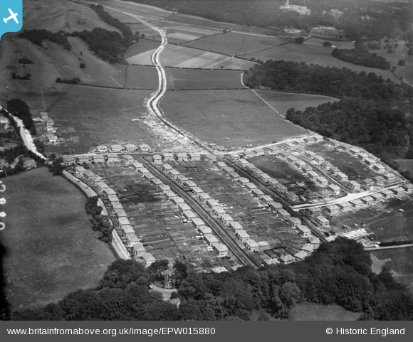
EPW015880 ENGLAND (1926). New housing at Farley Road, Selsdon, 1926
© Copyright OpenStreetMap contributors and licensed by the OpenStreetMap Foundation. 2026. Cartography is licensed as CC BY-SA.
Nearby Images (20)
EPW015880

EPW015886

EPW026616

EPW026622

EPW015887

EPW052480

EPW026619

EPW015883

EPW015884

EPW052481

EPW015881

EPW052493

EPW015891

EPW052482

EPW026618

EPW015879

EPW035581

EPW052491

EPW026624

EPW052492

Details
| Title | [EPW015880] New housing at Farley Road, Selsdon, 1926 |
| Reference | EPW015880 |
| Date | 25-June-1926 |
| Link | |
| Place name | SELSDON |
| Parish | |
| District | |
| Country | ENGLAND |
| Easting / Northing | 534831, 162439 |
| Longitude / Latitude | -0.063860267359577, 51.344519066675 |
| National Grid Reference | TQ348624 |
Pins

Dozymoo |
Sunday 24th of February 2013 10:29:35 PM | |

Class31 |
Saturday 3rd of November 2012 03:48:54 PM | |
|
Class31 |
Monday 29th of October 2012 08:32:23 PM | |
|
Class31 |
Monday 29th of October 2012 08:31:33 PM | |
|
Class31 |
Monday 29th of October 2012 08:30:36 PM | |
|
Class31 |
Monday 29th of October 2012 08:29:24 PM | |
|
Class31 |
Monday 29th of October 2012 08:28:04 PM | |
|
Class31 |
Monday 29th of October 2012 08:27:45 PM | |
|
Class31 |
Monday 29th of October 2012 08:27:25 PM |