
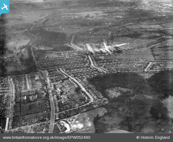
EPW052480 ENGLAND (1937). Gee Wood, Foxearth Road and surrounding housing, Selsdon, 1937. This image has been produced from a print.
© Copyright OpenStreetMap contributors and licensed by the OpenStreetMap Foundation. 2026. Cartography is licensed as CC BY-SA.
Nearby Images (21)
EPW052480

EPW015887

EPW015883

EPW026622

EPW015884

EPW015880

EPW026616

EPW015886

EPW052481

EPW052493

EPW026619

EPW015891

EPW015881

EPW052482

EPW052491

EPW026618

EPW052492

EPW015879

EPW035581

EPW026623

EPW026624

Details
| Title | [EPW052480] Gee Wood, Foxearth Road and surrounding housing, Selsdon, 1937. This image has been produced from a print. |
| Reference | EPW052480 |
| Date | 22-February-1937 |
| Link | |
| Place name | SELSDON |
| Parish | |
| District | |
| Country | ENGLAND |
| Easting / Northing | 534891, 162447 |
| Longitude / Latitude | -0.062996178690556, 51.344576728607 |
| National Grid Reference | TQ349624 |
