
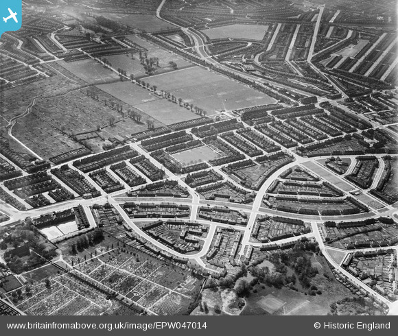
EPW047014 ENGLAND (1935). The White Hart Lane Estate, Tower Gardens, 1935
© Copyright OpenStreetMap contributors and licensed by the OpenStreetMap Foundation. 2026. Cartography is licensed as CC BY-SA.
Nearby Images (12)
EPW047014

EPW047015

EPW047011

EPW047016

EPW047020

EPW047017

EPW047013

EPW047010

EPW047018

EPW047012

EPW047019

EPW047009

Details
| Title | [EPW047014] The White Hart Lane Estate, Tower Gardens, 1935 |
| Reference | EPW047014 |
| Date | May-1935 |
| Link | |
| Place name | TOWER GARDENS |
| Parish | |
| District | |
| Country | ENGLAND |
| Easting / Northing | 532789, 190664 |
| Longitude / Latitude | -0.082556648505465, 51.598673153296 |
| National Grid Reference | TQ328907 |
Pins

DC |
Friday 21st of May 2021 05:15:20 PM | |
|
Bisto |
Monday 17th of November 2014 02:02:54 PM | |
|
Bisto |
Monday 17th of November 2014 02:00:48 PM | |
|
Hakan |
Wednesday 19th of February 2014 08:40:36 AM | |
|
Hakan |
Wednesday 19th of February 2014 08:39:43 AM | |
|
Hakan |
Wednesday 19th of February 2014 08:38:40 AM | |
|
Hakan |
Wednesday 19th of February 2014 08:38:00 AM |