
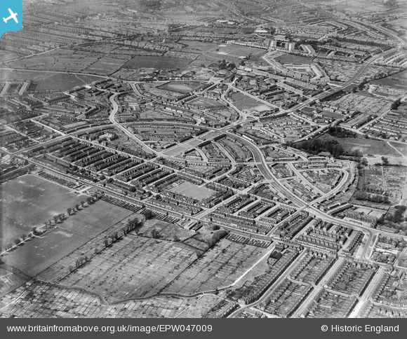
EPW047009 ENGLAND (1935). The White Hart Lane Estate, Tower Gardens, 1935
© Copyright OpenStreetMap contributors and licensed by the OpenStreetMap Foundation. 2026. Cartography is licensed as CC BY-SA.
Nearby Images (12)
EPW047009

EPW047019

EPW047012

EPW047017

EPW047018

EPW047010

EPW047013

EPW047020

EPW047015

EPW047016

EPW047011

EPW047014

Details
| Title | [EPW047009] The White Hart Lane Estate, Tower Gardens, 1935 |
| Reference | EPW047009 |
| Date | May-1935 |
| Link | |
| Place name | TOWER GARDENS |
| Parish | |
| District | |
| Country | ENGLAND |
| Easting / Northing | 532678, 190844 |
| Longitude / Latitude | -0.084090401154884, 51.600317033423 |
| National Grid Reference | TQ327908 |
Pins

De Freitas Family |
Friday 16th of October 2015 10:17:37 PM | |

Class31 |
Sunday 30th of November 2014 04:32:00 PM | |
|
Class31 |
Sunday 30th of November 2014 04:29:09 PM | |
|
Class31 |
Sunday 30th of November 2014 04:17:22 PM | |
|
Class31 |
Sunday 30th of November 2014 04:16:32 PM |


