
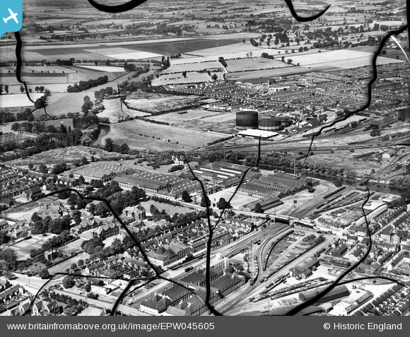
EPW045605 ENGLAND (1934). The Britannia Iron Works and environs, Bedford, from the east, 1934. This image has been produced from a damaged negative.
© Copyright OpenStreetMap contributors and licensed by the OpenStreetMap Foundation. 2026. Cartography is licensed as CC BY-SA.
Nearby Images (17)
EPW045605

EAW032057

EAW032053

EAW032056

EAW032060

EAW032054

EAW032062

EAW032051

EAW032063

EPW045530

EPW026475

EPW045525

EAW032059

EPW046443

EAW032058

EPW045529

EPW022392

Details
| Title | [EPW045605] The Britannia Iron Works and environs, Bedford, from the east, 1934. This image has been produced from a damaged negative. |
| Reference | EPW045605 |
| Date | July-1934 |
| Link | |
| Place name | BEDFORD |
| Parish | |
| District | |
| Country | ENGLAND |
| Easting / Northing | 504700, 249050 |
| Longitude / Latitude | -0.47027841905163, 52.129415157533 |
| National Grid Reference | TL047491 |
Pins
Be the first to add a comment to this image!