
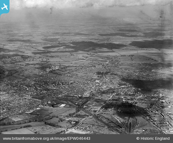
EPW046443 ENGLAND (1934). The town, Bedford, from the south-west, 1934
© Copyright OpenStreetMap contributors and licensed by the OpenStreetMap Foundation. 2026. Cartography is licensed as CC BY-SA.
Nearby Images (12)
EPW046443

EPW022392

EAW032057

EAW032056

EAW032062

EPW022382

EPW045605

EAW032053

EAW032054

EPW045530

EPW045529

EPW045525

Details
| Title | [EPW046443] The town, Bedford, from the south-west, 1934 |
| Reference | EPW046443 |
| Date | October-1934 |
| Link | |
| Place name | BEDFORD |
| Parish | |
| District | |
| Country | ENGLAND |
| Easting / Northing | 504651, 249283 |
| Longitude / Latitude | -0.47092235054183, 52.131518722356 |
| National Grid Reference | TL047493 |
Pins
 |

melgibbs |
Sunday 24th of November 2013 10:49:35 AM |
|
melgibbs |
Monday 10th of June 2013 08:18:03 PM | |
|
melgibbs |
Monday 10th of June 2013 08:16:39 PM | |
|
melgibbs |
Monday 10th of June 2013 08:16:10 PM | |
 |
melgibbs |
Monday 10th of June 2013 08:15:03 PM |
|
melgibbs |
Monday 10th of June 2013 08:12:14 PM | |
|
melgibbs |
Monday 10th of June 2013 08:10:30 PM | |
|
melgibbs |
Monday 10th of June 2013 08:08:34 PM | |
|
melgibbs |
Monday 10th of June 2013 08:07:46 PM | |
|
melgibbs |
Monday 10th of June 2013 08:07:08 PM | |
|
melgibbs |
Monday 10th of June 2013 08:05:30 PM | |
|
melgibbs |
Monday 10th of June 2013 08:04:52 PM | |
|
melgibbs |
Monday 10th of June 2013 08:03:31 PM | |
|
melgibbs |
Monday 10th of June 2013 08:02:38 PM | |
|
melgibbs |
Monday 10th of June 2013 08:01:50 PM | |
|
melgibbs |
Monday 10th of June 2013 07:59:49 PM | |
|
melgibbs |
Monday 10th of June 2013 07:52:21 PM | |
|
melgibbs |
Monday 10th of June 2013 07:46:04 PM | |
|
melgibbs |
Monday 10th of June 2013 07:45:34 PM | |
|
melgibbs |
Monday 10th of June 2013 07:45:02 PM | |
|
melgibbs |
Monday 10th of June 2013 07:43:47 PM | |
|
melgibbs |
Monday 10th of June 2013 07:42:37 PM | |
|
melgibbs |
Monday 10th of June 2013 07:42:01 PM | |
|
melgibbs |
Monday 10th of June 2013 07:41:31 PM | |
|
melgibbs |
Monday 10th of June 2013 07:40:23 PM | |
|
melgibbs |
Monday 10th of June 2013 07:39:39 PM | |
|
melgibbs |
Monday 10th of June 2013 07:38:38 PM | |
|
melgibbs |
Monday 10th of June 2013 07:38:11 PM | |
|
melgibbs |
Monday 10th of June 2013 07:37:41 PM | |
|
melgibbs |
Monday 10th of June 2013 07:37:10 PM | |
|
melgibbs |
Monday 10th of June 2013 07:36:45 PM | |
|
melgibbs |
Monday 10th of June 2013 07:35:49 PM | |
|
melgibbs |
Monday 10th of June 2013 07:35:20 PM | |
|
melgibbs |
Monday 10th of June 2013 07:34:10 PM | |
|
melgibbs |
Monday 10th of June 2013 07:31:47 PM | |
|
melgibbs |
Monday 10th of June 2013 07:30:25 PM | |
|
melgibbs |
Monday 10th of June 2013 07:29:47 PM | |
|
melgibbs |
Monday 10th of June 2013 07:28:27 PM | |
|
melgibbs |
Monday 10th of June 2013 07:27:59 PM | |
|
melgibbs |
Monday 10th of June 2013 07:27:03 PM | |
|
melgibbs |
Monday 10th of June 2013 07:26:38 PM | |
|
melgibbs |
Monday 10th of June 2013 07:25:59 PM | |
The 1924 map of Bedford has this stretch of road named as Cauldwell Road and becomes Prebend Street after the Commercial Road junction, but the whole length of road between Cauldwell Street corner and Midland Road is now called Prebend Street. |
melgibbs |
Saturday 22nd of June 2013 08:13:21 PM |
|
melgibbs |
Monday 10th of June 2013 07:25:23 PM | |
|
melgibbs |
Monday 10th of June 2013 07:24:47 PM | |
|
melgibbs |
Monday 10th of June 2013 07:24:16 PM | |
|
melgibbs |
Monday 10th of June 2013 07:21:28 PM | |
|
melgibbs |
Monday 10th of June 2013 07:19:52 PM | |
|
melgibbs |
Monday 10th of June 2013 07:19:20 PM | |
 |
melgibbs |
Monday 10th of June 2013 07:16:50 PM |
|
melgibbs |
Monday 10th of June 2013 07:13:48 PM | |
|
melgibbs |
Monday 10th of June 2013 07:06:41 PM | |
|
melgibbs |
Monday 10th of June 2013 07:06:08 PM | |
|
melgibbs |
Monday 10th of June 2013 07:05:36 PM |
User Comment Contributions

Granville Street taken on 30th October 2009. |
melgibbs |
Monday 10th of June 2013 07:18:34 PM |