
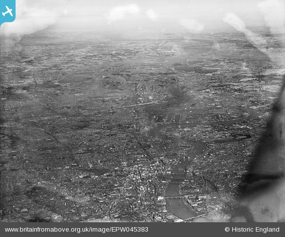
EPW045383 ENGLAND (1934). The view over the City and the East End of London towards the Thames Estuary, London, from the west, 1934. This image has been produced from a damaged negative.
© Copyright OpenStreetMap contributors and licensed by the OpenStreetMap Foundation. 2026. Cartography is licensed as CC BY-SA.
Nearby Images (13)
EPW045383

EAW011171

EAW011145

EAW021724

EPW045403

EPW005770

EAW048559

EAW011144

EAW004895

EAW025771

EAW011376

EPW055309

EAW011146

Details
| Title | [EPW045383] The view over the City and the East End of London towards the Thames Estuary, London, from the west, 1934. This image has been produced from a damaged negative. |
| Reference | EPW045383 |
| Date | July-1934 |
| Link | |
| Place name | LONDON |
| Parish | |
| District | |
| Country | ENGLAND |
| Easting / Northing | 533668, 181173 |
| Longitude / Latitude | -0.073480107512777, 51.513166515599 |
| National Grid Reference | TQ337812 |
Pins

Alan McFaden |
Wednesday 23rd of October 2013 10:38:56 AM | |
|
Alan McFaden |
Wednesday 23rd of October 2013 10:37:54 AM | |
|
Alan McFaden |
Wednesday 23rd of October 2013 10:36:57 AM | |
|
Alan McFaden |
Wednesday 23rd of October 2013 10:36:10 AM | |
|
Alan McFaden |
Wednesday 23rd of October 2013 10:35:10 AM | |
|
Alan McFaden |
Wednesday 23rd of October 2013 10:34:15 AM | |
|
Alan McFaden |
Wednesday 23rd of October 2013 10:32:51 AM | |
|
Alan McFaden |
Wednesday 23rd of October 2013 10:32:04 AM | |

g-bemy |
Friday 21st of June 2013 10:33:23 AM |


