
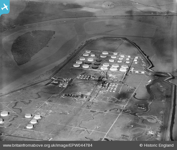
EPW044784 ENGLAND (1934). The Coryton Oil Refinery, Coryton, 1934
© Copyright OpenStreetMap contributors and licensed by the OpenStreetMap Foundation. 2026. Cartography is licensed as CC BY-SA.
Nearby Images (14)
EPW044784

EPW044785

EAW048301

EAW034432

EAW048360

EPW044783

EPW044782

EPW044787

EAW048300

EAW039887

EAW048370

EPW045635

EAW043891

EAW047428

Details
| Title | [EPW044784] The Coryton Oil Refinery, Coryton, 1934 |
| Reference | EPW044784 |
| Date | June-1934 |
| Link | |
| Place name | CORYTON |
| Parish | |
| District | |
| Country | ENGLAND |
| Easting / Northing | 575738, 182346 |
| Longitude / Latitude | 0.53288693788172, 51.512185671742 |
| National Grid Reference | TQ757823 |
Pins

Essex Explorer |
Tuesday 5th of November 2013 06:02:13 PM | |
|
Essex Explorer |
Tuesday 5th of November 2013 06:01:31 PM |