
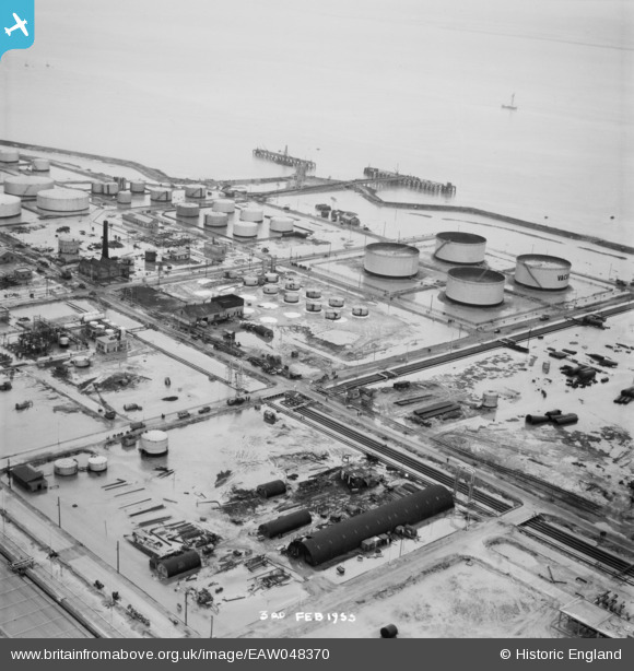
EAW048370 ENGLAND (1953). Flooding at the Coryton Oil Refinery, Coryton, 1953. This image was marked by Aerofilms Ltd for photo editing.
© Copyright OpenStreetMap contributors and licensed by the OpenStreetMap Foundation. 2026. Cartography is licensed as CC BY-SA.
Nearby Images (23)
EAW048370

EAW048300

EAW048363

EPW044783

EAW034432

EAW034431

EAW039887

EAW048301

EAW043888

EAW045738

EAW035773

EAW034405

EAW048360

EPW044785

EAW039888

EAW048369

EAW048098

EPW044784

EPW044787

EAW045736

EAW034434

EAW034408

EAW048377

Details
| Title | [EAW048370] Flooding at the Coryton Oil Refinery, Coryton, 1953. This image was marked by Aerofilms Ltd for photo editing. |
| Reference | EAW048370 |
| Date | 3-February-1953 |
| Link | |
| Place name | CORYTON |
| Parish | |
| District | |
| Country | ENGLAND |
| Easting / Northing | 575590, 182152 |
| Longitude / Latitude | 0.53065944588201, 51.510488850067 |
| National Grid Reference | TQ756822 |
Pins
Be the first to add a comment to this image!