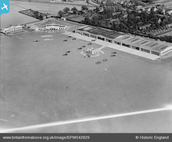
EPW042829 ENGLAND (1933). Hatfield Aerodrome Club House and hangars, Hatfield, 1933
© Copyright OpenStreetMap contributors and licensed by the OpenStreetMap Foundation. 2026. Cartography is licensed as CC BY-SA.
Nearby Images (11)
Details
| Title | [EPW042829] Hatfield Aerodrome Club House and hangars, Hatfield, 1933 |
| Reference | EPW042829 |
| Date | August-1933 |
| Link | |
| Place name | HATFIELD |
| Parish | HATFIELD |
| District | |
| Country | ENGLAND |
| Easting / Northing | 521295, 208684 |
| Longitude / Latitude | -0.24217750320637, 51.763230090402 |
| National Grid Reference | TL213087 |
Pins

boxsterman |
Saturday 15th of June 2013 10:44:58 PM |


![[EPW042829] Hatfield Aerodrome Club House and hangars, Hatfield, 1933](http://britainfromabove.org.uk/sites/all/libraries/aerofilms-images/public/100x100/EPW/042/EPW042829.jpg)
![[EPW042828] Hatfield Aerodrome Club House and hangars, Hatfield, 1933](http://britainfromabove.org.uk/sites/all/libraries/aerofilms-images/public/100x100/EPW/042/EPW042828.jpg)
![[EPW042825] Hatfield Aerodrome Club House and hangars, Hatfield, 1933](http://britainfromabove.org.uk/sites/all/libraries/aerofilms-images/public/100x100/EPW/042/EPW042825.jpg)
![[EPW042827] Hatfield Aerodrome Club House, Swimming Pool and hangars, Hatfield, 1933](http://britainfromabove.org.uk/sites/all/libraries/aerofilms-images/public/100x100/EPW/042/EPW042827.jpg)
![[EPW061123] Birchwood, Roe Green, Hatfield Aerodrome and environs, Hatfield, 1939](http://britainfromabove.org.uk/sites/all/libraries/aerofilms-images/public/100x100/EPW/061/EPW061123.jpg)
![[EPW061120] Hatfield Aerodrome, Hatfield, 1939](http://britainfromabove.org.uk/sites/all/libraries/aerofilms-images/public/100x100/EPW/061/EPW061120.jpg)
![[EPW046577] Hatfield Aerodrome, Hatfield, 1935](http://britainfromabove.org.uk/sites/all/libraries/aerofilms-images/public/100x100/EPW/046/EPW046577.jpg)
![[EPW042826] Hatfield Aerodrome Swimming Pool, Hatfield, 1933](http://britainfromabove.org.uk/sites/all/libraries/aerofilms-images/public/100x100/EPW/042/EPW042826.jpg)
![[EPW042830] Hatfield Aerodrome, Hatfield, 1933](http://britainfromabove.org.uk/sites/all/libraries/aerofilms-images/public/100x100/EPW/042/EPW042830.jpg)
![[EPW047566] Hangars, the club house and De Havilland Works at Hatfield Aerodrome, Hatfield, 1935](http://britainfromabove.org.uk/sites/all/libraries/aerofilms-images/public/100x100/EPW/047/EPW047566.jpg)
![[EPW046580] The Barnet Bypass and buildings at Hatfield Aerodrome, Hatfield, 1935](http://britainfromabove.org.uk/sites/all/libraries/aerofilms-images/public/100x100/EPW/046/EPW046580.jpg)