
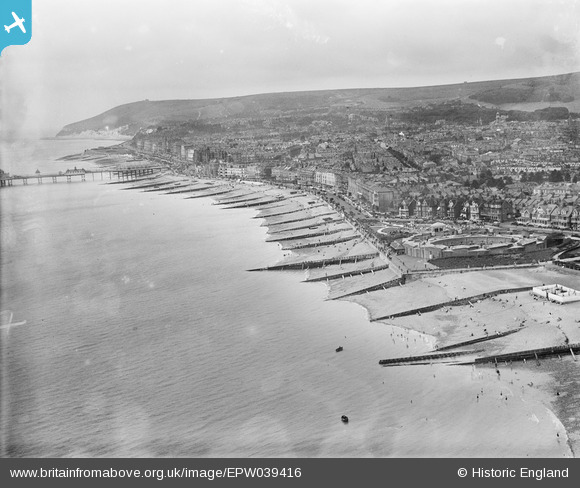
EPW039416 ENGLAND (1932). The Eastbourne Redoubt, groynes along the seafront and the town, Eastbourne, from the north-east, 1932
© Copyright OpenStreetMap contributors and licensed by the OpenStreetMap Foundation. 2026. Cartography is licensed as CC BY-SA.
Nearby Images (7)
EPW039416

EPW051367

EPW000101

EPW042973

EPW039414

EPW051368

EPW000102

Details
| Title | [EPW039416] The Eastbourne Redoubt, groynes along the seafront and the town, Eastbourne, from the north-east, 1932 |
| Reference | EPW039416 |
| Date | August-1932 |
| Link | |
| Place name | EASTBOURNE |
| Parish | |
| District | |
| Country | ENGLAND |
| Easting / Northing | 562457, 99643 |
| Longitude / Latitude | 0.30432657329479, 50.773020389745 |
| National Grid Reference | TV625996 |
Pins

Alan McFaden |
Wednesday 20th of November 2013 10:56:08 PM | |
|
Alan McFaden |
Wednesday 20th of November 2013 10:55:22 PM | |
|
Alan McFaden |
Wednesday 20th of November 2013 10:54:11 PM |


