
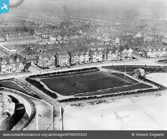
EPW000102 ENGLAND (1920). The Redoubt Bowling Green, Eastbourne, 1920
© Copyright OpenStreetMap contributors and licensed by the OpenStreetMap Foundation. 2026. Cartography is licensed as CC BY-SA.
Nearby Images (8)
EPW000102

EPW000101

EPW042973

EPW039414

EPW051367

EPW000076

EPW051368

EPW039416

Details
| Title | [EPW000102] The Redoubt Bowling Green, Eastbourne, 1920 |
| Reference | EPW000102 |
| Date | February-1920 |
| Link | |
| Place name | EASTBOURNE |
| Parish | |
| District | |
| Country | ENGLAND |
| Easting / Northing | 562265, 99807 |
| Longitude / Latitude | 0.30167791585474, 50.774547904421 |
| National Grid Reference | TV623998 |
Pins
Be the first to add a comment to this image!
User Comment Contributions
On the far left you can see the very edge of the Redoubt Fortress. |

former user |
Saturday 30th of June 2012 11:47:54 PM |