
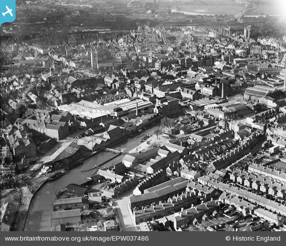
EPW037486 ENGLAND (1932). The Seven Bridges Brewery and Malthouses alongside the River Kennet and the town, Reading, 1932
© Copyright OpenStreetMap contributors and licensed by the OpenStreetMap Foundation. 2026. Cartography is licensed as CC BY-SA.
Nearby Images (18)
EPW037486

EPW037481

EPW037485

EPW037487

EPW037482

EPW037026

EPW037495

EPW037484

EPW037029

EPW037483

EPW037488

EPW037031

EPW037028

EPW037030

EPW037027

EPW037489

EPW022681

EPW022687

Details
| Title | [EPW037486] The Seven Bridges Brewery and Malthouses alongside the River Kennet and the town, Reading, 1932 |
| Reference | EPW037486 |
| Date | April-1932 |
| Link | |
| Place name | READING |
| Parish | |
| District | |
| Country | ENGLAND |
| Easting / Northing | 471453, 173066 |
| Longitude / Latitude | -0.97158525424517, 51.451574638861 |
| National Grid Reference | SU715731 |
Pins
Be the first to add a comment to this image!