
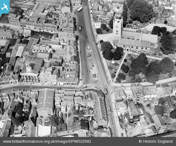
EPW022681 ENGLAND (1928). St Mary's Church and St Mary's Butts, Reading, 1928
© Copyright OpenStreetMap contributors and licensed by the OpenStreetMap Foundation. 2026. Cartography is licensed as CC BY-SA.
Nearby Images (23)
EPW022681

EPW022687

EPW037028

EPW037495

EPW037027

EPW037030

EPW037488

EPW037482

EPW037487

EPW037489

EPW037483

EPW037031

EPW037481

EPW037486

EPW037485

EPW000879

EPW022700

EAW034972

EPW037029

EPW037026

EAW034973

EAW034975

EPW000865

Details
| Title | [EPW022681] St Mary's Church and St Mary's Butts, Reading, 1928 |
| Reference | EPW022681 |
| Date | 15-August-1928 |
| Link | |
| Place name | READING |
| Parish | |
| District | |
| Country | ENGLAND |
| Easting / Northing | 471378, 173277 |
| Longitude / Latitude | -0.97262194782918, 51.453481230122 |
| National Grid Reference | SU714733 |
Pins
Robert Tims |
Wednesday 16th of January 2013 04:57:39 PM | |

Nowy Paul |
Monday 22nd of October 2012 11:07:54 AM | |
|
MB |
Sunday 21st of October 2012 09:45:47 AM | |
|
Norman W |
Saturday 29th of September 2012 04:24:17 PM | |
|
Norman W |
Saturday 29th of September 2012 04:23:26 PM | |
|
Norman W |
Saturday 29th of September 2012 04:21:33 PM | |
|
Norman W |
Saturday 29th of September 2012 04:20:03 PM |