
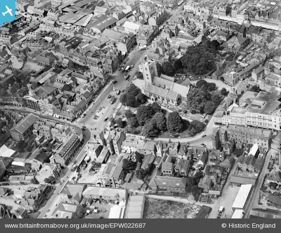
EPW022687 ENGLAND (1928). St Mary's Church and St Mary's Butts, Reading, 1928
© Copyright OpenStreetMap contributors and licensed by the OpenStreetMap Foundation. 2026. Cartography is licensed as CC BY-SA.
Nearby Images (20)
EPW022687

EPW022681

EPW037028

EPW000879

EAW034972

EPW037495

EPW037489

EPW037488

EPW037027

EPW037030

EPW037482

EPW037483

EPW037487

EPW037481

EPW037485

EPW037486

EPW037031

EPW022700

EAW034973

EAW034975

Details
| Title | [EPW022687] St Mary's Church and St Mary's Butts, Reading, 1928 |
| Reference | EPW022687 |
| Date | 15-August-1928 |
| Link | |
| Place name | READING |
| Parish | |
| District | |
| Country | ENGLAND |
| Easting / Northing | 471409, 173302 |
| Longitude / Latitude | -0.97217077877482, 51.453702098268 |
| National Grid Reference | SU714733 |
Pins

Norman W |
Thursday 27th of September 2012 04:36:44 PM | |
|
Norman W |
Thursday 27th of September 2012 04:32:52 PM | |
|
Norman W |
Thursday 27th of September 2012 04:30:22 PM | |
|
Norman W |
Thursday 27th of September 2012 04:28:05 PM | |
|
Norman W |
Thursday 27th of September 2012 04:26:46 PM | |
|
Norman W |
Thursday 27th of September 2012 04:26:03 PM | |
|
Norman W |
Thursday 27th of September 2012 04:16:28 PM |