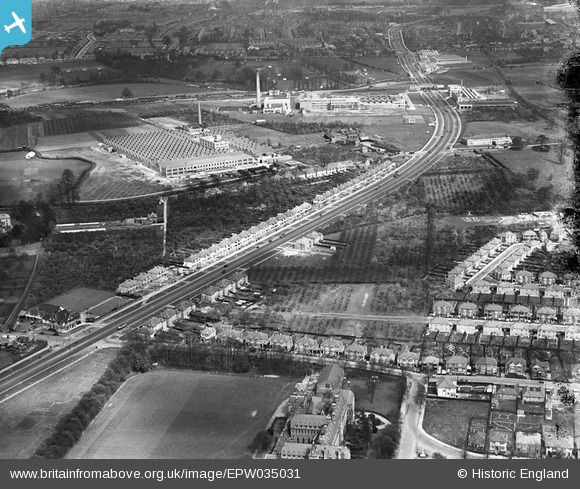
EPW035031 ENGLAND (1931). The Imperial Biscuit Works, Firestone Rubber Tyre Manufactory and the Great West Road, Osterley, 1931
    © Copyright OpenStreetMap contributors and licensed by the OpenStreetMap Foundation. 2025. Cartography is licensed as CC BY-SA.
  
Nearby Images (11)
Details
| Title | [EPW035031] The Imperial Biscuit Works, Firestone Rubber Tyre Manufactory and the Great West Road, Osterley, 1931 | 
| Reference | EPW035031 | 
| Date | May-1931 | 
| Link | |
| Place name | OSTERLEY | 
| Parish | |
| District | |
| Country | ENGLAND | 
| Easting / Northing | 515880, 177316 | 
| Longitude / Latitude | -0.33099460991255, 51.482426632396 | 
| National Grid Reference | TQ159773 | 
Pins
|  Borough Road College |   CJC | Tuesday 27th of April 2021 08:07:48 PM | 
 
             
  ![[EPW035031] The Imperial Biscuit Works, Firestone Rubber Tyre Manufactory and the Great West Road, Osterley, 1931](http://britainfromabove.org.uk/sites/all/libraries/aerofilms-images/public/100x100/EPW/035/EPW035031.jpg) 
  
                                          ![[EPW035029] The Great West Road and construction of housing on Syon Lane, Osterley, 1931](http://britainfromabove.org.uk/sites/all/libraries/aerofilms-images/public/100x100/EPW/035/EPW035029.jpg) 
 ![[EPW035021] The Imperial Biscuit Works, Firestone Rubber Tyre Manufactory and the Great West Road, Osterley, 1931](http://britainfromabove.org.uk/sites/all/libraries/aerofilms-images/public/100x100/EPW/035/EPW035021.jpg) 
 ![[EPW035026] Wyke House and the Great West Road, Osterley, 1931](http://britainfromabove.org.uk/sites/all/libraries/aerofilms-images/public/100x100/EPW/035/EPW035026.jpg) 
 ![[EPR000526] The Church of St Francis of Assisi on the Great West Road, Spring Grove, 1935](http://britainfromabove.org.uk/sites/all/libraries/aerofilms-images/public/100x100/EPR/000/EPR000526.jpg) 
 ![[EPW035025] The Great West Road and construction of housing on Syon Lane, Osterley, 1931](http://britainfromabove.org.uk/sites/all/libraries/aerofilms-images/public/100x100/EPW/035/EPW035025.jpg) 
 ![[EPW035030] The Imperial Biscuit Works and the Great West Road, Osterley, 1931](http://britainfromabove.org.uk/sites/all/libraries/aerofilms-images/public/100x100/EPW/035/EPW035030.jpg) 
 ![[EPW040959] The Imperial Biscuit Works and environs, Brentford, from the south-west, 1933](http://britainfromabove.org.uk/sites/all/libraries/aerofilms-images/public/100x100/EPW/040/EPW040959.jpg) 
 ![[EPW035036] The Great West Road and construction of new housing on Syon Lane, Osterley, 1931](http://britainfromabove.org.uk/sites/all/libraries/aerofilms-images/public/100x100/EPW/035/EPW035036.jpg) 
 ![[EPR000689] The Great West Road at Brentford End, Brentford, from the south-west, 1935](http://britainfromabove.org.uk/sites/all/libraries/aerofilms-images/public/100x100/EPR/000/EPR000689.jpg) 
 ![[EPW035038] The Great West Road and new housing development around Wood Lane and environs, Osterley, 1931](http://britainfromabove.org.uk/sites/all/libraries/aerofilms-images/public/100x100/EPW/035/EPW035038.jpg)