
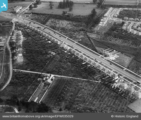
EPW035029 ENGLAND (1931). The Great West Road and construction of housing on Syon Lane, Osterley, 1931
© Copyright OpenStreetMap contributors and licensed by the OpenStreetMap Foundation. 2026. Cartography is licensed as CC BY-SA.
Nearby Images (11)
EPW035029

EPW035031

EPW035021

EPW035026

EPW035025

EPR000526

EPW035030

EPW040959

EPW035036

EPR000689

EPW032161

Details
| Title | [EPW035029] The Great West Road and construction of housing on Syon Lane, Osterley, 1931 |
| Reference | EPW035029 |
| Date | April-1931 |
| Link | |
| Place name | OSTERLEY |
| Parish | |
| District | |
| Country | ENGLAND |
| Easting / Northing | 515890, 177352 |
| Longitude / Latitude | -0.33083883028642, 51.482748176775 |
| National Grid Reference | TQ159774 |
Pins
Be the first to add a comment to this image!