
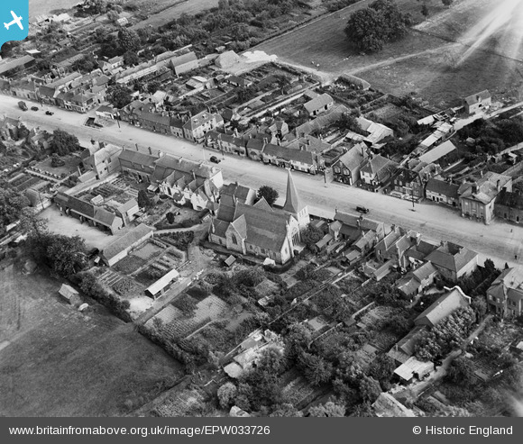
EPW033726 ENGLAND (1930). St Peter's Church and the High Street, Stockbridge, 1930
© Copyright OpenStreetMap contributors and licensed by the OpenStreetMap Foundation. 2026. Cartography is licensed as CC BY-SA.
Nearby Images (5)
EPW033726

EPW023307

EPW023308

EPW033725

EPW033728

Details
| Title | [EPW033726] St Peter's Church and the High Street, Stockbridge, 1930 |
| Reference | EPW033726 |
| Date | July-1930 |
| Link | |
| Place name | STOCKBRIDGE |
| Parish | STOCKBRIDGE |
| District | |
| Country | ENGLAND |
| Easting / Northing | 435554, 135134 |
| Longitude / Latitude | -1.4920189831006, 51.113865211512 |
| National Grid Reference | SU356351 |
Pins

Class31 |
Wednesday 30th of October 2013 09:47:25 AM |

User Comment Contributions
Looking south east. |
Class31 |
Wednesday 30th of October 2013 09:39:09 AM |