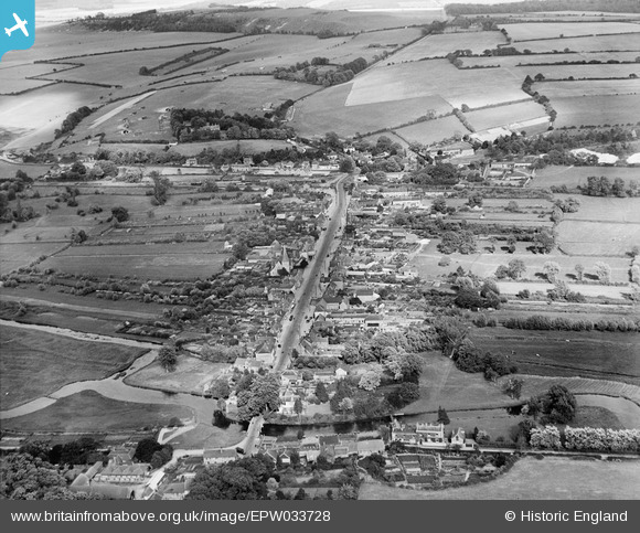
EPW033728 ENGLAND (1930). The High Street, Stockbridge, from the west, 1930
© Copyright OpenStreetMap contributors and licensed by the OpenStreetMap Foundation. 2026. Cartography is licensed as CC BY-SA.
Details
| Title | [EPW033728] The High Street, Stockbridge, from the west, 1930 |
| Reference | EPW033728 |
| Date | July-1930 |
| Link | |
| Place name | STOCKBRIDGE |
| Parish | STOCKBRIDGE |
| District | |
| Country | ENGLAND |
| Easting / Northing | 435351, 135135 |
| Longitude / Latitude | -1.4949191449987, 51.113886766973 |
| National Grid Reference | SU354351 |
Pins
Be the first to add a comment to this image!


![[EPW033728] The High Street, Stockbridge, from the west, 1930](http://britainfromabove.org.uk/sites/all/libraries/aerofilms-images/public/100x100/EPW/033/EPW033728.jpg)
![[EPW023307] St Peter's Church and the High Street, Stockbridge, 1928](http://britainfromabove.org.uk/sites/all/libraries/aerofilms-images/public/100x100/EPW/023/EPW023307.jpg)
![[EPW033726] St Peter's Church and the High Street, Stockbridge, 1930](http://britainfromabove.org.uk/sites/all/libraries/aerofilms-images/public/100x100/EPW/033/EPW033726.jpg)
![[EPW033727] The town, Stockbridge, from the south-west, 1930](http://britainfromabove.org.uk/sites/all/libraries/aerofilms-images/public/100x100/EPW/033/EPW033727.jpg)
