
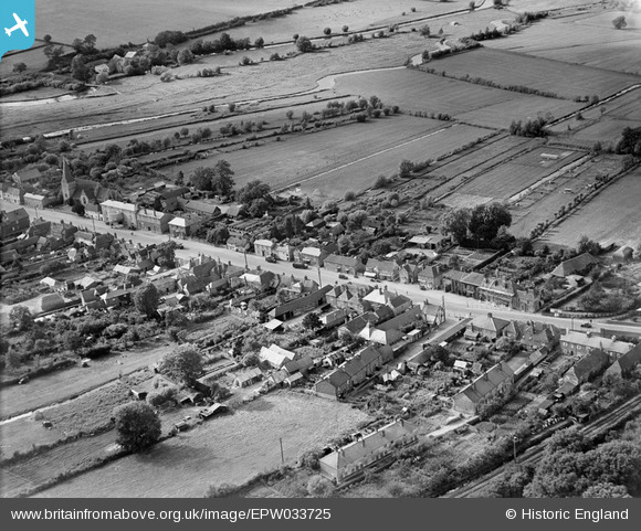
EPW033725 ENGLAND (1930). The High Street, Stockbridge, 1930
© Copyright OpenStreetMap contributors and licensed by the OpenStreetMap Foundation. 2026. Cartography is licensed as CC BY-SA.
Nearby Images (6)
EPW033725

EPW023308

EPW033726

EPW023307

EPW033731

EPW023306

Details
| Title | [EPW033725] The High Street, Stockbridge, 1930 |
| Reference | EPW033725 |
| Date | July-1930 |
| Link | |
| Place name | STOCKBRIDGE |
| Parish | STOCKBRIDGE |
| District | |
| Country | ENGLAND |
| Easting / Northing | 435725, 135112 |
| Longitude / Latitude | -1.4895780882399, 51.113656732946 |
| National Grid Reference | SU357351 |
