
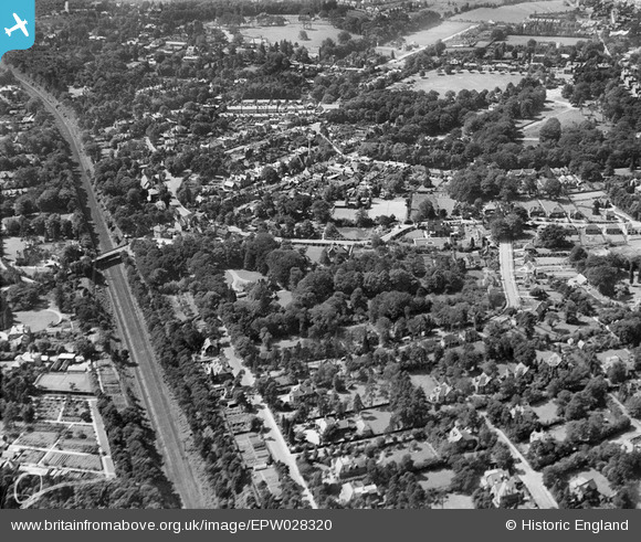
EPW028320 ENGLAND (1929). Haines Bridge and housing around High Pine Close and environs, Weybridge, 1929
© Copyright OpenStreetMap contributors and licensed by the OpenStreetMap Foundation. 2026. Cartography is licensed as CC BY-SA.
Nearby Images (8)
EPW028320

EPW017554

EPW028321

EPW028333

EPW017551

EPW017550

EPW028327

EPW017549

Details
| Title | [EPW028320] Haines Bridge and housing around High Pine Close and environs, Weybridge, 1929 |
| Reference | EPW028320 |
| Date | August-1929 |
| Link | |
| Place name | WEYBRIDGE |
| Parish | |
| District | |
| Country | ENGLAND |
| Easting / Northing | 508488, 164404 |
| Longitude / Latitude | -0.44137128175188, 51.36782355931 |
| National Grid Reference | TQ085644 |
Pins
Be the first to add a comment to this image!