
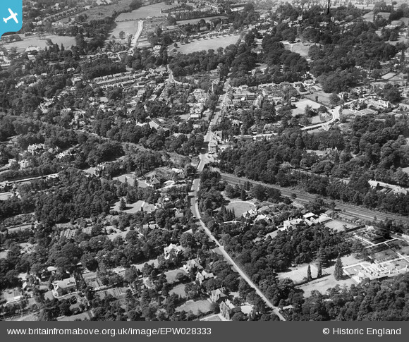
EPW028333 ENGLAND (1929). Haines Bridge and Queens Road, Weybridge, 1929
© Copyright OpenStreetMap contributors and licensed by the OpenStreetMap Foundation. 2026. Cartography is licensed as CC BY-SA.
Nearby Images (5)
EPW028333

EPW028321

EPW028320

EPW028327

EPW017551

Details
| Title | [EPW028333] Haines Bridge and Queens Road, Weybridge, 1929 |
| Reference | EPW028333 |
| Date | August-1929 |
| Link | |
| Place name | WEYBRIDGE |
| Parish | |
| District | |
| Country | ENGLAND |
| Easting / Northing | 508470, 164231 |
| Longitude / Latitude | -0.44168257978733, 51.366271835263 |
| National Grid Reference | TQ085642 |
