
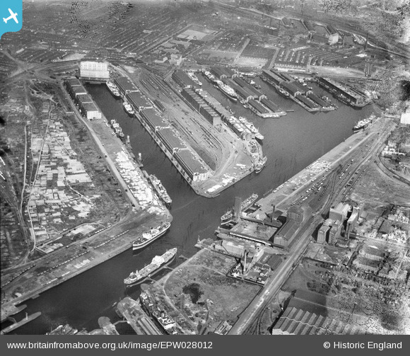
EPW028012 ENGLAND (1929). Salford Docks, Salford, 1929
© Copyright OpenStreetMap contributors and licensed by the OpenStreetMap Foundation. 2026. Cartography is licensed as CC BY-SA.
Nearby Images (19)
EPW028012

EPW028013

EAW050418

EPW028011

EPW027854

EAW017329

EPW028149

EPW027729

EPW017596

EPW028015

EPW045987

EPW027860

EAW000804

EAW050419

EPW027857

EPW027781

EAW044197
 Flour and Provender Mill, Trafford Park, 1952. This image was marked by Aerofilms Ltd for photo editing.")
EPW027784

EAW017318

Details
| Title | [EPW028012] Salford Docks, Salford, 1929 |
| Reference | EPW028012 |
| Date | July-1929 |
| Link | |
| Place name | SALFORD |
| Parish | |
| District | |
| Country | ENGLAND |
| Easting / Northing | 380465, 397173 |
| Longitude / Latitude | -2.294326859684, 53.470676251174 |
| National Grid Reference | SJ805972 |
Pins

Bottom Yard |
Thursday 28th of February 2019 07:31:59 PM | |
|
Bottom Yard |
Thursday 28th of February 2019 07:31:19 PM | |
|
Bottom Yard |
Thursday 28th of February 2019 07:29:19 PM | |
|
Bottom Yard |
Thursday 28th of February 2019 07:16:04 PM |