
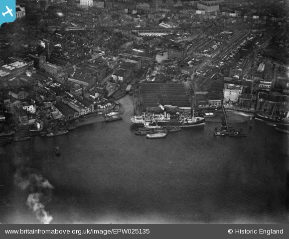
EPW025135 ENGLAND (1928). Limekiln Dock and surrounding warehouses, Limehouse, 1928. This image has been produced from a print.
© Copyright OpenStreetMap contributors and licensed by the OpenStreetMap Foundation. 2026. Cartography is licensed as CC BY-SA.
Nearby Images (19)
EPW025135

EPW025134

EAW048410

EAW048410
EAW048411

EAW048411
EAW048417

EAW048417
EAW048416

EAW048413

EAW048420

EAW048415

EAW048412

EAW048414

EAW048419

EAW048418

EAW048418
EPW060798

EPW010938

Details
| Title | [EPW025135] Limekiln Dock and surrounding warehouses, Limehouse, 1928. This image has been produced from a print. |
| Reference | EPW025135 |
| Date | 23-October-1928 |
| Link | |
| Place name | LIMEHOUSE |
| Parish | |
| District | |
| Country | ENGLAND |
| Easting / Northing | 536720, 180603 |
| Longitude / Latitude | -0.029741209663468, 51.507313396185 |
| National Grid Reference | TQ367806 |
Pins

Class31 |
Monday 30th of March 2015 08:11:24 AM |
