
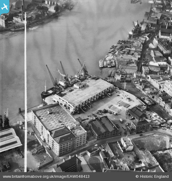
EAW048413 ENGLAND (1953). Dundee Wharf, Limehouse, 1953. This image was marked by Aerofilms Ltd for photo editing.
© Copyright OpenStreetMap contributors and licensed by the OpenStreetMap Foundation. 2026. Cartography is licensed as CC BY-SA.
Nearby Images (19)
EAW048413

EAW048420

EAW048416

EAW048417

EAW048417
EAW048410

EAW048410
EPW025134

EAW048412

EAW048415

EAW048411

EAW048411
EPW025135

EAW048419

EPW060798

EAW048418

EAW048418
EAW048414

EPW010938

Details
| Title | [EAW048413] Dundee Wharf, Limehouse, 1953. This image was marked by Aerofilms Ltd for photo editing. |
| Reference | EAW048413 |
| Date | 7-February-1953 |
| Link | |
| Place name | LIMEHOUSE |
| Parish | |
| District | |
| Country | ENGLAND |
| Easting / Northing | 536756, 180590 |
| Longitude / Latitude | -0.02922778952996, 51.507187850439 |
| National Grid Reference | TQ368806 |
Pins
Be the first to add a comment to this image!