
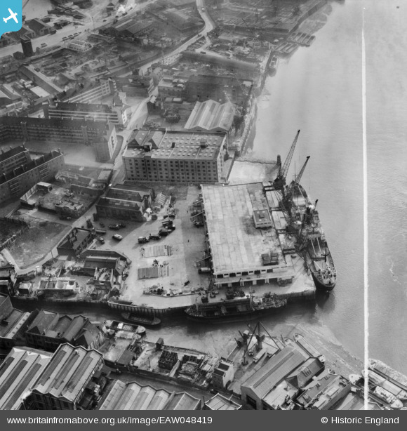
EAW048419 ENGLAND (1953). The SS Angusburn moored at Dundee Wharf, Limehouse, 1953. This image was marked by Aerofilms Ltd for photo editing.
© Copyright OpenStreetMap contributors and licensed by the OpenStreetMap Foundation. 2026. Cartography is licensed as CC BY-SA.
Nearby Images (19)
EAW048419

EPW060798

EAW048412

EAW048420

EAW048413

EAW048418

EAW048418
EAW048416

EAW048417

EAW048417
EAW048410

EAW048410
EAW048415

EPW025134

EAW048414

EAW048411

EAW048411
EPW025135

EPW010938

Details
| Title | [EAW048419] The SS Angusburn moored at Dundee Wharf, Limehouse, 1953. This image was marked by Aerofilms Ltd for photo editing. |
| Reference | EAW048419 |
| Date | 7-February-1953 |
| Link | |
| Place name | LIMEHOUSE |
| Parish | |
| District | |
| Country | ENGLAND |
| Easting / Northing | 536797, 180597 |
| Longitude / Latitude | -0.028634604298242, 51.507240835282 |
| National Grid Reference | TQ368806 |
Pins

Chaz |
Friday 12th of January 2024 10:44:29 PM |