
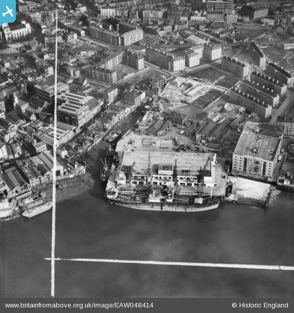
EAW048414 ENGLAND (1953). The SS Angusburn moored at Dundee Wharf, Limehouse, 1953. This image was marked by Aerofilms Ltd for photo editing.
© Copyright OpenStreetMap contributors and licensed by the OpenStreetMap Foundation. 2026. Cartography is licensed as CC BY-SA.
Nearby Images (19)
EAW048414

EAW048418

EAW048418
EAW048415

EAW048412

EAW048411

EAW048411
EAW048410

EAW048410
EPW060798

EAW048417

EAW048417
EAW048419

EPW025134

EAW048416

EAW048420

EAW048413

EPW025135

EPW010938

Details
| Title | [EAW048414] The SS Angusburn moored at Dundee Wharf, Limehouse, 1953. This image was marked by Aerofilms Ltd for photo editing. |
| Reference | EAW048414 |
| Date | 7-February-1953 |
| Link | |
| Place name | LIMEHOUSE |
| Parish | |
| District | |
| Country | ENGLAND |
| Easting / Northing | 536777, 180652 |
| Longitude / Latitude | -0.028901301929723, 51.50773997161 |
| National Grid Reference | TQ368807 |
Pins

Robin |
Friday 22nd of January 2021 11:52:41 PM | |
|
Stu Giles |
Monday 21st of May 2018 08:33:00 PM | |
|
DEG |
Sunday 25th of June 2017 05:31:19 PM | |
|
moses72 |
Monday 2nd of November 2015 04:32:32 PM | |
|
moses72 |
Monday 2nd of November 2015 04:31:56 PM | |
|
moses72 |
Monday 2nd of November 2015 04:30:49 PM | |
|
moses72 |
Monday 2nd of November 2015 04:30:11 PM |