
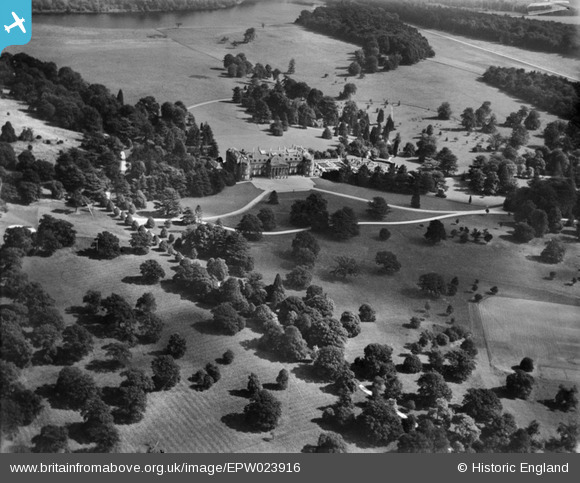
EPW023916 ENGLAND (1928). Luton Hoo house and park, Luton Hoo, 1928
© Copyright OpenStreetMap contributors and licensed by the OpenStreetMap Foundation. 2026. Cartography is licensed as CC BY-SA.
Nearby Images (8)
EPW023916

EAW016038

EAW016037

EPW023845

EAW016036

EPW023914

EAW016034

EPW005363

Details
| Title | [EPW023916] Luton Hoo house and park, Luton Hoo, 1928 |
| Reference | EPW023916 |
| Date | September-1928 |
| Link | |
| Place name | LUTON HOO |
| Parish | HYDE |
| District | |
| Country | ENGLAND |
| Easting / Northing | 510314, 218510 |
| Longitude / Latitude | -0.39811667321272, 51.853822818179 |
| National Grid Reference | TL103185 |
Pins
Be the first to add a comment to this image!