
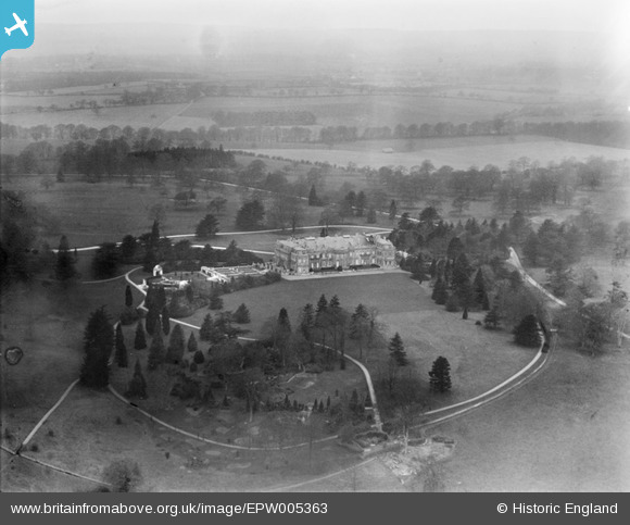
EPW005363 ENGLAND (1921). Luton Hoo, Luton Hoo Park, from the north-east, 1921
© Copyright OpenStreetMap contributors and licensed by the OpenStreetMap Foundation. 2026. Cartography is licensed as CC BY-SA.
Nearby Images (9)
EPW005363

EAW016035

EPW023914

EAW016034

EAW016036

EPW023845

EAW016037

EAW016038

EPW023916

Details
| Title | [EPW005363] Luton Hoo, Luton Hoo Park, from the north-east, 1921 |
| Reference | EPW005363 |
| Date | 16-March-1921 |
| Link | |
| Place name | LUTON HOO PARK |
| Parish | HYDE |
| District | |
| Country | ENGLAND |
| Easting / Northing | 510546, 218575 |
| Longitude / Latitude | -0.39472840442769, 51.854361155455 |
| National Grid Reference | TL105186 |
Pins
Be the first to add a comment to this image!