
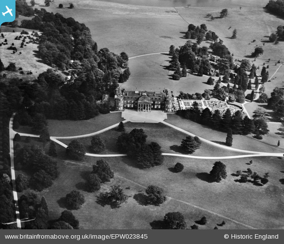
EPW023845 ENGLAND (1928). Luton Hoo house and park, Luton Hoo, 1928
© Copyright OpenStreetMap contributors and licensed by the OpenStreetMap Foundation. 2026. Cartography is licensed as CC BY-SA.
Nearby Images (9)
EPW023845

EAW016037

EAW016036

EAW016038

EPW023914

EAW016034

EPW023916

EPW005363

EAW016035

Details
| Title | [EPW023845] Luton Hoo house and park, Luton Hoo, 1928 |
| Reference | EPW023845 |
| Date | September-1928 |
| Link | |
| Place name | LUTON HOO |
| Parish | HYDE |
| District | |
| Country | ENGLAND |
| Easting / Northing | 510423, 218540 |
| Longitude / Latitude | -0.39652495306346, 51.85407091322 |
| National Grid Reference | TL104185 |
Pins

MB |
Tuesday 6th of November 2012 07:56:24 PM | |
|
MB |
Tuesday 6th of November 2012 07:53:35 PM | |
|
MB |
Tuesday 6th of November 2012 07:51:01 PM | |
|
MB |
Tuesday 6th of November 2012 07:42:25 PM |
User Comment Contributions
The stable block, probably hidden in the trees on the left of the house, was used by the RAF as accommodation for trainee pilots during World War II. Hugh Popham, author of 'Sea Flight. The Wartime Memoirs of a Fleet Air Arm Pilot', recalled staying there under a leaking roof |
MB |
Sunday 18th of November 2012 10:27:37 PM |
A history including the building's architecture by Robert Adam, modified by Smirke in 1830, on Wikipedia, here: en.wikipedia.org/wiki/Luton_Hoo |
MB |
Tuesday 6th of November 2012 07:45:40 PM |
Now a five-star hotel, spa and golf course: www.lutonhoo.co.uk/gallery |
MB |
Tuesday 6th of November 2012 07:41:00 PM |