
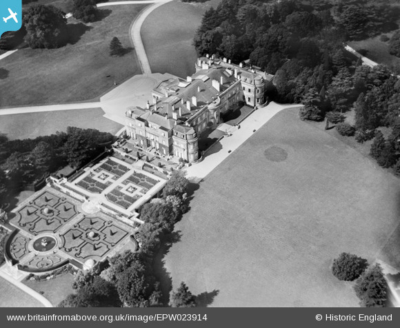
EPW023914 ENGLAND (1928). Luton Hoo house and formal gardens, Luton Hoo, 1928
© Copyright OpenStreetMap contributors and licensed by the OpenStreetMap Foundation. 2026. Cartography is licensed as CC BY-SA.
Nearby Images (9)
EPW023914

EAW016036

EPW023845

EPW005363

EAW016037

EAW016034

EAW016038

EAW016035

EPW023916

Details
| Title | [EPW023914] Luton Hoo house and formal gardens, Luton Hoo, 1928 |
| Reference | EPW023914 |
| Date | September-1928 |
| Link | |
| Place name | LUTON HOO |
| Parish | HYDE |
| District | |
| Country | ENGLAND |
| Easting / Northing | 510489, 218538 |
| Longitude / Latitude | -0.39556759854599, 51.85403987233 |
| National Grid Reference | TL105185 |
Pins
User Comment Contributions
Now Luton Hoo Hotel Golf and Spa retaining most of the original fabric |

doomwatch |
Saturday 30th of June 2012 11:01:16 AM |