
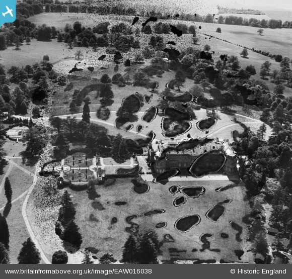
EAW016038 ENGLAND (1948). Luton Hoo House and Park, Luton Hoo, 1948. This image has been produced from a damaged negative.
© Copyright OpenStreetMap contributors and licensed by the OpenStreetMap Foundation. 2026. Cartography is licensed as CC BY-SA.
Nearby Images (9)
EAW016038

EPW023845

EAW016037

EPW023916

EPW023914

EAW016036

EAW016034

EPW005363

EAW016035

Details
| Title | [EAW016038] Luton Hoo House and Park, Luton Hoo, 1948. This image has been produced from a damaged negative. |
| Reference | EAW016038 |
| Date | 19-May-1948 |
| Link | |
| Place name | LUTON HOO |
| Parish | HYDE |
| District | |
| Country | ENGLAND |
| Easting / Northing | 510400, 218486 |
| Longitude / Latitude | -0.39687605146257, 51.853590088176 |
| National Grid Reference | TL104185 |
Pins
Be the first to add a comment to this image!