
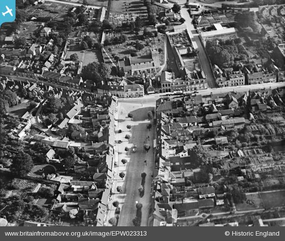
EPW023313 ENGLAND (1928). Broad Street and St John the Baptist's Church, New Alresford, 1928
© Copyright OpenStreetMap contributors and licensed by the OpenStreetMap Foundation. 2026. Cartography is licensed as CC BY-SA.
Nearby Images (10)
EPW023313

EPW023310

EPW032308

EPW023311

EPW032307

EPW023309

EPW023314

EAW040902

EPW032306

EPW023315

Details
| Title | [EPW023313] Broad Street and St John the Baptist's Church, New Alresford, 1928 |
| Reference | EPW023313 |
| Date | September-1928 |
| Link | |
| Place name | NEW ALRESFORD |
| Parish | NEW ALRESFORD |
| District | |
| Country | ENGLAND |
| Easting / Northing | 458824, 132713 |
| Longitude / Latitude | -1.1599721238157, 51.090178488669 |
| National Grid Reference | SU588327 |
Pins
Be the first to add a comment to this image!
User Comment Contributions
Its a great pity Broad ST doesn't look like this anymore, a sign of the times.. |

RichardT |
Tuesday 26th of June 2012 10:36:32 PM |