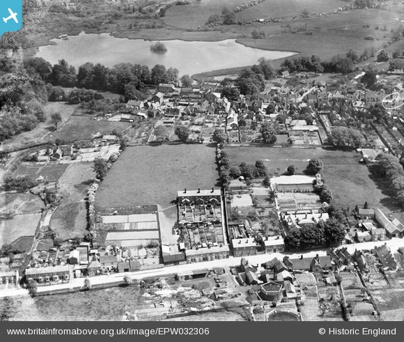
EPW032306 ENGLAND (1930). The Dean, Old Alresford Pond and The Soke, New Alresford, 1930
© Copyright OpenStreetMap contributors and licensed by the OpenStreetMap Foundation. 2026. Cartography is licensed as CC BY-SA.
Nearby Images (7)
Details
| Title | [EPW032306] The Dean, Old Alresford Pond and The Soke, New Alresford, 1930 |
| Reference | EPW032306 |
| Date | June-1930 |
| Link | |
| Place name | NEW ALRESFORD |
| Parish | NEW ALRESFORD |
| District | |
| Country | ENGLAND |
| Easting / Northing | 458629, 132876 |
| Longitude / Latitude | -1.162730007619, 51.091664185946 |
| National Grid Reference | SU586329 |
Pins

RLL |
Tuesday 8th of January 2019 05:36:37 PM | |

RLL |
Tuesday 8th of January 2019 05:35:41 PM | |

RLL |
Tuesday 8th of January 2019 05:34:34 PM | |

David960 |
Thursday 29th of January 2015 06:01:11 PM |


![[EPW032306] The Dean, Old Alresford Pond and The Soke, New Alresford, 1930](http://britainfromabove.org.uk/sites/all/libraries/aerofilms-images/public/100x100/EPW/032/EPW032306.jpg)
![[EAW040892] The town centre, New Alresford, 1951. This image has been produced from a print marked by Aerofilms Ltd for photo editing.](http://britainfromabove.org.uk/sites/all/libraries/aerofilms-images/public/100x100/EAW/040/EAW040892.jpg)
![[EPW023309] The High Street and town centre, New Alresford, 1928](http://britainfromabove.org.uk/sites/all/libraries/aerofilms-images/public/100x100/EPW/023/EPW023309.jpg)
![[EPW032307] The town, Old Alresford Pond and Old Alresford Park, New Alresford, 1930](http://britainfromabove.org.uk/sites/all/libraries/aerofilms-images/public/100x100/EPW/032/EPW032307.jpg)
![[EPW023313] Broad Street and St John the Baptist's Church, New Alresford, 1928](http://britainfromabove.org.uk/sites/all/libraries/aerofilms-images/public/100x100/EPW/023/EPW023313.jpg)
![[EPW023310] Broad Street and St John the Baptist's Church, New Alresford, 1928](http://britainfromabove.org.uk/sites/all/libraries/aerofilms-images/public/100x100/EPW/023/EPW023310.jpg)
![[EPW032308] St John the Baptist's Church, East Street and the town centre, New Alresford, 1930](http://britainfromabove.org.uk/sites/all/libraries/aerofilms-images/public/100x100/EPW/032/EPW032308.jpg)