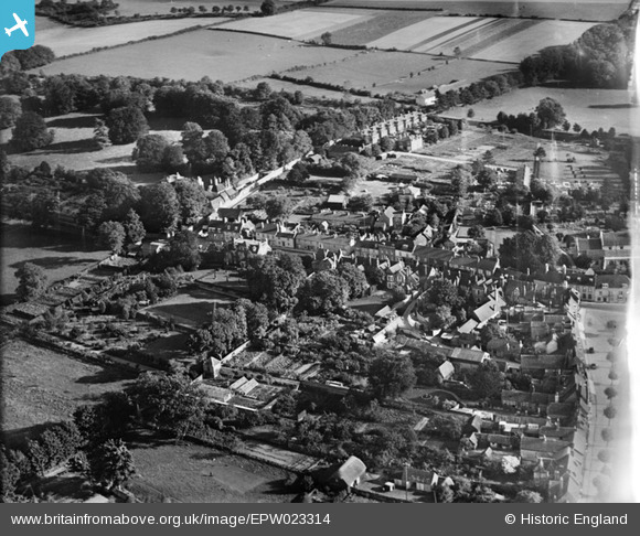
EPW023314 ENGLAND (1928). East Street and environs, New Alresford, 1928
© Copyright OpenStreetMap contributors and licensed by the OpenStreetMap Foundation. 2026. Cartography is licensed as CC BY-SA.
Nearby Images (7)
Details
| Title | [EPW023314] East Street and environs, New Alresford, 1928 |
| Reference | EPW023314 |
| Date | September-1928 |
| Link | |
| Place name | NEW ALRESFORD |
| Parish | NEW ALRESFORD |
| District | |
| Country | ENGLAND |
| Easting / Northing | 458963, 132691 |
| Longitude / Latitude | -1.1579909755773, 51.089966383609 |
| National Grid Reference | SU590327 |


![[EPW023314] East Street and environs, New Alresford, 1928](http://britainfromabove.org.uk/sites/all/libraries/aerofilms-images/public/100x100/EPW/023/EPW023314.jpg)
![[EPW023311] The town centre, New Alresford, 1928](http://britainfromabove.org.uk/sites/all/libraries/aerofilms-images/public/100x100/EPW/023/EPW023311.jpg)
![[EPW023310] Broad Street and St John the Baptist's Church, New Alresford, 1928](http://britainfromabove.org.uk/sites/all/libraries/aerofilms-images/public/100x100/EPW/023/EPW023310.jpg)
![[EAW040902] The town, New Alresford, from the east, 1951](http://britainfromabove.org.uk/sites/all/libraries/aerofilms-images/public/100x100/EAW/040/EAW040902.jpg)
![[EPW032308] St John the Baptist's Church, East Street and the town centre, New Alresford, 1930](http://britainfromabove.org.uk/sites/all/libraries/aerofilms-images/public/100x100/EPW/032/EPW032308.jpg)
![[EPW023313] Broad Street and St John the Baptist's Church, New Alresford, 1928](http://britainfromabove.org.uk/sites/all/libraries/aerofilms-images/public/100x100/EPW/023/EPW023313.jpg)
![[EPW032307] The town, Old Alresford Pond and Old Alresford Park, New Alresford, 1930](http://britainfromabove.org.uk/sites/all/libraries/aerofilms-images/public/100x100/EPW/032/EPW032307.jpg)
