
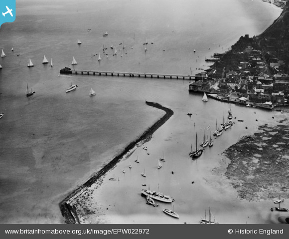
EPW022972 ENGLAND (1928). Yarmouth Pier and Marina, Norton, 1928. This image has been produced from a copy-negative.
© Copyright OpenStreetMap contributors and licensed by the OpenStreetMap Foundation. 2026. Cartography is licensed as CC BY-SA.
Nearby Images (7)
EPW022972

EPW000501

EPW022971

EPW022974

EPW022975

EAW022200

EAW022197

Details
| Title | [EPW022972] Yarmouth Pier and Marina, Norton, 1928. This image has been produced from a copy-negative. |
| Reference | EPW022972 |
| Date | August-1928 |
| Link | |
| Place name | NORTON |
| Parish | FRESHWATER |
| District | |
| Country | ENGLAND |
| Easting / Northing | 435287, 89829 |
| Longitude / Latitude | -1.5002159682432, 50.706450684907 |
| National Grid Reference | SZ353898 |
Pins
Be the first to add a comment to this image!