
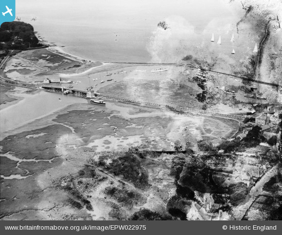
EPW022975 ENGLAND (1928). The Yar Bridge and harbour, Yarmouth, 1928. This image has been produced from a damaged negative.
© Copyright OpenStreetMap contributors and licensed by the OpenStreetMap Foundation. 2026. Cartography is licensed as CC BY-SA.
Nearby Images (6)
EPW022975

EAW022197

EPW022974

EPW022972

EPW000501

EAW022200

Details
| Title | [EPW022975] The Yar Bridge and harbour, Yarmouth, 1928. This image has been produced from a damaged negative. |
| Reference | EPW022975 |
| Date | August-1928 |
| Link | |
| Place name | YARMOUTH |
| Parish | YARMOUTH |
| District | |
| Country | ENGLAND |
| Easting / Northing | 435263, 89610 |
| Longitude / Latitude | -1.5005767997594, 50.704482589227 |
| National Grid Reference | SZ353896 |
Pins
Be the first to add a comment to this image!
User Comment Contributions
Should be "Yare bridge", not 'Yar'. |

J Langley |
Saturday 4th of August 2012 11:31:47 PM |