
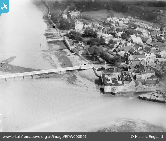
EPW000501 ENGLAND (1920). Yarmouth Pier, Yarmouth, Isle of Wight, 1920
© Copyright OpenStreetMap contributors and licensed by the OpenStreetMap Foundation. 2026. Cartography is licensed as CC BY-SA.
Nearby Images (6)
EPW000501

EPW022971

EPW022974

EPW022972

EPW022973

EPW022975

Details
| Title | [EPW000501] Yarmouth Pier, Yarmouth, Isle of Wight, 1920 |
| Reference | EPW000501 |
| Date | April-1920 |
| Link | |
| Place name | YARMOUTH |
| Parish | YARMOUTH |
| District | |
| Country | ENGLAND |
| Easting / Northing | 435444, 89811 |
| Longitude / Latitude | -1.4979941333423, 50.706279250758 |
| National Grid Reference | SZ354898 |
