
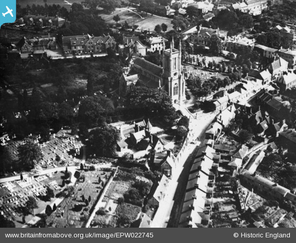
EPW022745 ENGLAND (1928). St Mary's Church, Andover, 1928. This image has been produced from a copy-negative.
© Copyright OpenStreetMap contributors and licensed by the OpenStreetMap Foundation. 2026. Cartography is licensed as CC BY-SA.
Nearby Images (9)
EPW022745

EPW022736

EPW022738

EPW023297

EPW023295

EPW023298

EPW011129

EPW011128

EPW011123

Details
| Title | [EPW022745] St Mary's Church, Andover, 1928. This image has been produced from a copy-negative. |
| Reference | EPW022745 |
| Date | August-1928 |
| Link | |
| Place name | ANDOVER |
| Parish | ANDOVER |
| District | |
| Country | ENGLAND |
| Easting / Northing | 436503, 145798 |
| Longitude / Latitude | -1.4773781506364, 51.209703187729 |
| National Grid Reference | SU365458 |
Pins
Be the first to add a comment to this image!