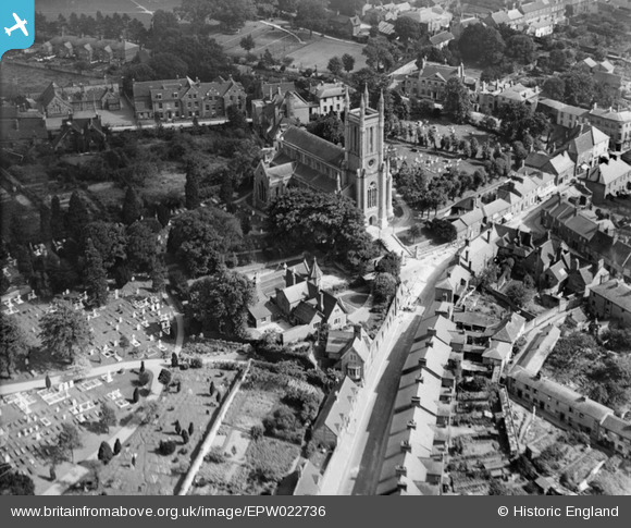
EPW022736 ENGLAND (1928). St Mary's Church, Andover, 1928
© Copyright OpenStreetMap contributors and licensed by the OpenStreetMap Foundation. 2026. Cartography is licensed as CC BY-SA.
Nearby Images (8)
EPW022736

EPW022745

EPW023297

EPW022738

EPW023295

EPW023298

EPW011129

EPW011128

Details
| Title | [EPW022736] St Mary's Church, Andover, 1928 |
| Reference | EPW022736 |
| Date | August-1928 |
| Link | |
| Place name | ANDOVER |
| Parish | ANDOVER |
| District | |
| Country | ENGLAND |
| Easting / Northing | 436503, 145801 |
| Longitude / Latitude | -1.4773778452686, 51.209730165467 |
| National Grid Reference | SU365458 |
Pins

Class31 |
Friday 3rd of April 2015 08:21:04 AM | |

David960 |
Tuesday 3rd of February 2015 11:20:19 PM | |
|
David960 |
Tuesday 3rd of February 2015 11:19:00 PM | |
|
David960 |
Tuesday 3rd of February 2015 11:15:33 PM | |
|
David960 |
Tuesday 3rd of February 2015 11:14:39 PM | |
|
David960 |
Tuesday 3rd of February 2015 11:13:07 PM |