
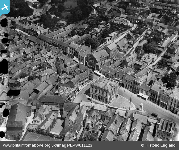
EPW011123 ENGLAND (1924). The Town Hall and environs, Andover, 1924
© Copyright OpenStreetMap contributors and licensed by the OpenStreetMap Foundation. 2026. Cartography is licensed as CC BY-SA.
Nearby Images (20)
EPW011123

EPW011120

EPW011122

EPW016872

EPW011121

EPW011125

EPW023296

EPW023294

EPW022744

EAW051916

EPW011129

EPW023298

EPW023295

EPW016871

EPW022738

EPW022745

EAW051914

EAW051915

EPW011128

EPW022737

Details
| Title | [EPW011123] The Town Hall and environs, Andover, 1924 |
| Reference | EPW011123 |
| Date | July-1924 |
| Link | |
| Place name | ANDOVER |
| Parish | ANDOVER |
| District | |
| Country | ENGLAND |
| Easting / Northing | 436483, 145550 |
| Longitude / Latitude | -1.4776897107477, 51.207474305952 |
| National Grid Reference | SU365456 |
Pins

Mike |
Wednesday 26th of February 2025 11:57:52 AM | |
|
David960 |
Tuesday 3rd of February 2015 11:55:02 PM | |
|
David960 |
Tuesday 3rd of February 2015 11:53:39 PM |