
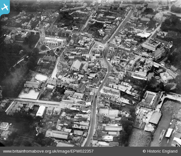
EPW022357 ENGLAND (1928). The town centre, Bishop's Stortford, 1928
© Copyright OpenStreetMap contributors and licensed by the OpenStreetMap Foundation. 2026. Cartography is licensed as CC BY-SA.
Nearby Images (7)
EPW022357

EPW022356

EPW001740

EPW001741

EPW001742

EPW001772

EPW001978

Details
| Title | [EPW022357] The town centre, Bishop's Stortford, 1928 |
| Reference | EPW022357 |
| Date | 8-August-1928 |
| Link | |
| Place name | BISHOP'S STORTFORD |
| Parish | BISHOP'S STORTFORD |
| District | |
| Country | ENGLAND |
| Easting / Northing | 548746, 221313 |
| Longitude / Latitude | 0.16079318796992, 51.870090340807 |
| National Grid Reference | TL487213 |
Pins

Randolph |
Sunday 10th of April 2022 06:11:59 PM | |
|
Emily Cole |
Friday 18th of June 2021 02:04:47 PM | |
|
GeorgeF |
Monday 9th of September 2019 08:49:08 PM |