
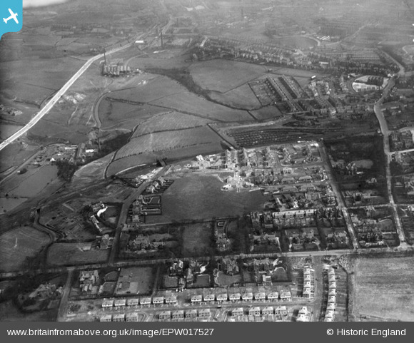
EPW017527 ENGLAND (1927). Housing under construction, Crumpsall, 1927
© Copyright OpenStreetMap contributors and licensed by the OpenStreetMap Foundation. 2026. Cartography is licensed as CC BY-SA.
Nearby Images (13)
EPW017527

EPW047477

EPW046175

EPW047475

EPW046174

EPW047476

EPW048639

EPW048662

EPW048641

EPW048633

EPW048660

EPW047474

EPW048643

Details
| Title | [EPW017527] Housing under construction, Crumpsall, 1927 |
| Reference | EPW017527 |
| Date | March-1927 |
| Link | |
| Place name | CRUMPSALL |
| Parish | |
| District | |
| Country | ENGLAND |
| Easting / Northing | 383955, 402729 |
| Longitude / Latitude | -2.2420290825404, 53.520739225461 |
| National Grid Reference | SD840027 |
Pins
User Comment Contributions
View east, with Middleton Road running left to right about a quarter of the way up the picture. |

OldiePhil |
Tuesday 18th of June 2013 07:56:54 PM |