
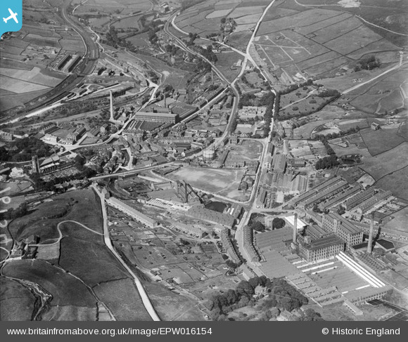
EPW016154 ENGLAND (1926). The town centre, Marsden, 1926
© Copyright OpenStreetMap contributors and licensed by the OpenStreetMap Foundation. 2026. Cartography is licensed as CC BY-SA.
Nearby Images (11)
EPW016154

EAW002569

EAW002560

EPW016153

EAW002559

EAW002555
 and the village, Marsden, 1946")
EPW016152

EAW002563
 and environs, Marsden, 1946")
EAW002565
, Marsden, 1946")
EAW002567

EAW002554
 and the village, Marsden, from the north-east, 1946")
Details
| Title | [EPW016154] The town centre, Marsden, 1926 |
| Reference | EPW016154 |
| Date | 2-July-1926 |
| Link | |
| Place name | MARSDEN |
| Parish | |
| District | |
| Country | ENGLAND |
| Easting / Northing | 404917, 411469 |
| Longitude / Latitude | -1.9256921585811, 53.599528209419 |
| National Grid Reference | SE049115 |
Pins
Be the first to add a comment to this image!