
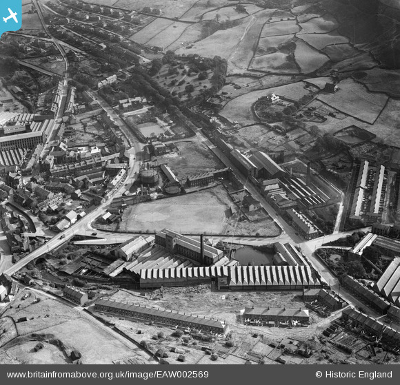
EAW002569 ENGLAND (1946). Fall Lane Woollen Mills and Football Ground, Marsden, 1946
© Copyright OpenStreetMap contributors and licensed by the OpenStreetMap Foundation. 2026. Cartography is licensed as CC BY-SA.
Nearby Images (12)
EAW002569

EAW002560

EPW016154

EAW002559

EPW016153

EAW002567

EAW002568

EAW002555
 and the village, Marsden, 1946")
EAW002558

EAW002566

EAW002563
 and environs, Marsden, 1946")
EAW002556

Details
| Title | [EAW002569] Fall Lane Woollen Mills and Football Ground, Marsden, 1946 |
| Reference | EAW002569 |
| Date | 16-September-1946 |
| Link | |
| Place name | MARSDEN |
| Parish | |
| District | |
| Country | ENGLAND |
| Easting / Northing | 404929, 411409 |
| Longitude / Latitude | -1.9255117583556, 53.59898873841 |
| National Grid Reference | SE049114 |
Pins

redmist |
Monday 18th of November 2019 08:48:18 PM | |
|
redmist |
Monday 18th of November 2019 08:47:38 PM | |
|
redmist |
Monday 18th of November 2019 08:46:47 PM | |
|
redmist |
Monday 18th of November 2019 08:46:33 PM | |
|
redmist |
Monday 18th of November 2019 08:46:17 PM | |
|
redmist |
Monday 18th of November 2019 08:45:52 PM |