
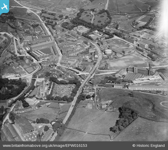
EPW016153 ENGLAND (1926). The town centre, Marsden, 1926
© Copyright OpenStreetMap contributors and licensed by the OpenStreetMap Foundation. 2026. Cartography is licensed as CC BY-SA.
Nearby Images (10)
EPW016153

EPW016154

EAW002569

EAW002560

EPW016152

EAW002562
 and environs, Marsden, 1946")
EAW002555
 and the village, Marsden, 1946")
EAW002565
, Marsden, 1946")
EAW002559

EAW002561
 and environs, Marsden, 1946")
Details
| Title | [EPW016153] The town centre, Marsden, 1926 |
| Reference | EPW016153 |
| Date | 2-July-1926 |
| Link | |
| Place name | MARSDEN |
| Parish | |
| District | |
| Country | ENGLAND |
| Easting / Northing | 404811, 411537 |
| Longitude / Latitude | -1.9272930256007, 53.600140466038 |
| National Grid Reference | SE048115 |
Pins
Be the first to add a comment to this image!