
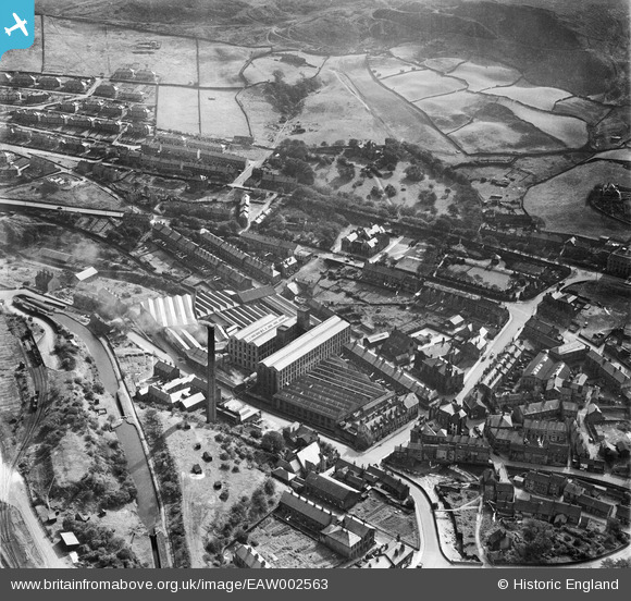
EAW002563 ENGLAND (1946). New Mills (Woollen) and environs, Marsden, 1946
© Copyright OpenStreetMap contributors and licensed by the OpenStreetMap Foundation. 2026. Cartography is licensed as CC BY-SA.
Nearby Images (9)
EAW002563
 and environs, Marsden, 1946")
EAW002554
 and the village, Marsden, from the north-east, 1946")
EAW002555
 and the village, Marsden, 1946")
EAW002565
, Marsden, 1946")
EAW002561
 and environs, Marsden, 1946")
EAW002562
 and environs, Marsden, 1946")
EPW016152

EPW016154

EAW002569

Details
| Title | [EAW002563] New Mills (Woollen) and environs, Marsden, 1946 |
| Reference | EAW002563 |
| Date | 16-September-1946 |
| Link | |
| Place name | MARSDEN |
| Parish | |
| District | |
| Country | ENGLAND |
| Easting / Northing | 405094, 411632 |
| Longitude / Latitude | -1.9230145961646, 53.600991774903 |
| National Grid Reference | SE051116 |
Pins

redmist |
Monday 18th of November 2019 08:25:38 PM | |
|
redmist |
Monday 18th of November 2019 08:25:18 PM | |
|
redmist |
Monday 18th of November 2019 08:24:57 PM | |
|
redmist |
Monday 18th of November 2019 08:23:40 PM | |
|
redmist |
Monday 18th of November 2019 08:23:22 PM | |
|
redmist |
Monday 18th of November 2019 07:41:41 PM |