
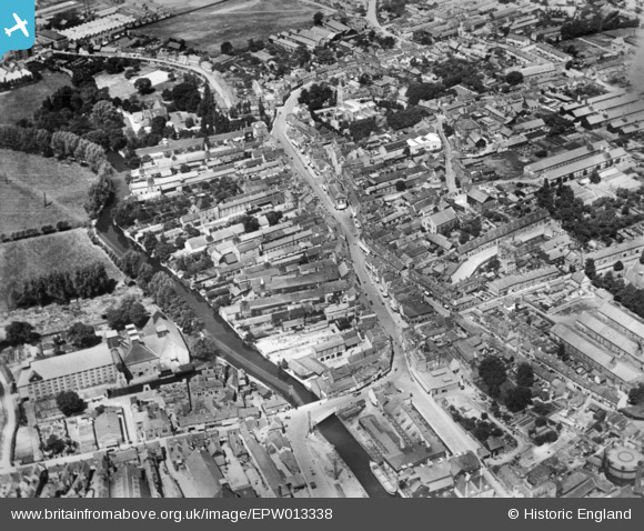
EPW013338 ENGLAND (1925). The town centre, Ware, 1925. This image has been produced from a copy-negative.
© Copyright OpenStreetMap contributors and licensed by the OpenStreetMap Foundation. 2026. Cartography is licensed as CC BY-SA.
Nearby Images (17)
EPW013338

EAW022367

EPW025932

EAW022366

EPW025936

EPW025935

EPW025934

EAW022404

EAW022403

EAW022365

EPW025931

EAW022401

EAW022399

EAW022400

EPW025928

EPW013340

EPW025929

Details
| Title | [EPW013338] The town centre, Ware, 1925. This image has been produced from a copy-negative. |
| Reference | EPW013338 |
| Date | June-1925 |
| Link | |
| Place name | WARE |
| Parish | WARE |
| District | |
| Country | ENGLAND |
| Easting / Northing | 535821, 214277 |
| Longitude / Latitude | -0.029602253218425, 51.810157667467 |
| National Grid Reference | TL358143 |
Pins
Be the first to add a comment to this image!