
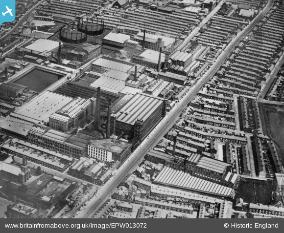
EPW013072 ENGLAND (1925). Cotton Mills between Ribbleton Lane and New Hall Lane, Preston, 1925. This image has been produced from a copy-negative.
© Copyright OpenStreetMap contributors and licensed by the OpenStreetMap Foundation. 2026. Cartography is licensed as CC BY-SA.
Nearby Images (21)
EPW013072

EAW015898

EAW015897

EAW015895

EAW015896

EAW015900

EAW034004

EPW004016

EAW015899

EAW015929

EAW015882

EAW015901

EAW034002

EAW015881

EAW034003

EAW034006

EAW033999

EAW034005

EAW034001

EAW015887

EAW015885

Details
| Title | [EPW013072] Cotton Mills between Ribbleton Lane and New Hall Lane, Preston, 1925. This image has been produced from a copy-negative. |
| Reference | EPW013072 |
| Date | June-1925 |
| Link | |
| Place name | PRESTON |
| Parish | |
| District | |
| Country | ENGLAND |
| Easting / Northing | 355030, 429692 |
| Longitude / Latitude | -2.682222091389, 53.761420115681 |
| National Grid Reference | SD550297 |
Pins
Be the first to add a comment to this image!