
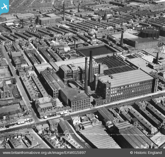
EAW015897 ENGLAND (1948). New Preston Cotton Mills, Preston, 1948. This image was marked by Aerofilms Ltd for photo editing.
© Copyright OpenStreetMap contributors and licensed by the OpenStreetMap Foundation. 2026. Cartography is licensed as CC BY-SA.
Nearby Images (20)
EAW015897

EAW015898

EPW013072

EAW015895

EAW015896

EAW015900

EAW015929

EAW015901

EAW015899

EAW034004

EAW034002

EAW033999

EAW034003

EAW034005

EAW015928

EAW034001

EAW034006

EAW015927

EAW034000

EAW015887

Details
| Title | [EAW015897] New Preston Cotton Mills, Preston, 1948. This image was marked by Aerofilms Ltd for photo editing. |
| Reference | EAW015897 |
| Date | 20-May-1948 |
| Link | |
| Place name | PRESTON |
| Parish | |
| District | |
| Country | ENGLAND |
| Easting / Northing | 354964, 429722 |
| Longitude / Latitude | -2.6832276501432, 53.761684066779 |
| National Grid Reference | SD550297 |

